Babusar Top, or Babusar Pass, is a mountain pass in the north of the 150 km (93 miles) long Kaghan Valley that connects it to Chilas on the Karakoram Highway at an elevation of 4,173 meters or 13,691 feet above sea level (KKH). It is the Babusar Valley’s highest point.
Babusar top was named after the great Mughal emperor Babur who passed through the area in the 16th century. It was formally know as Babur Top however, now the location adopted the name Babusar Top.
My Trip to Babusar Top
My family and I went to Babusar Top last September. It was an unforgettable and daring tour. We started our journey in Islamabad and stayed in Naran. Our goal was to go to Babusar Top. Babusar peak is approximately 65.6 km (2h 28 min) from Naran. So, the next day, at 8:00 a.m., we left Naran.
We stopped to admire the river Kunhaar on our way from Naran to Babusar Top. It was breathtaking, surrounded by lush green mountains, with beautiful weather and clean air without pollution. We rested for a while, took some photos, and then resumed our joyous journey.
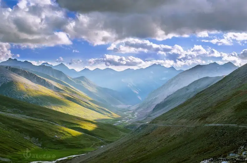
The trip to Babusar Top is a very beautiful one. There will be trees, beautiful mountains, streams, and glaciers everywhere. and sights you’ll never forget for the rest of your life. After about 2.5 hours of travel, we got to the beautiful Lulusar Lake. Also, the road is in very bad shape, but the scenery is very beautiful. We got to Babusar Top after 5 hours.
When you get to the top, it’s really cool. On a cold day, there are clouds all around. Keep in mind that you are more than 4000 meters above sea level, which is the height of huge mountains. At this level, the amount of oxygen drops, which could make you feel sick. The best thing to do is not run or do anything hard.
Overall, my journey to Babusar Top has been incredible. Here are some pointers I picked up on my trip that will help you plan your next trip to Babusar Top!
How to get to Babusar Top
Off-road cars are the best choice for this route. People think that the Babusar road is one of the most unsafe because there are so many car crashes there every year, and 70% of them are caused by new drivers. During the summer, vehicles can conveniently and safely get to the top and back down again. But when there is a roadblock, they often have trouble. So, before you plan a trip, it’s best to find out how the roads and weather are.
Things to Consider Before Traveling
- It takes 8 hours to get from Islamabad to Naran, and 2 hours to get from Naran to Babusar.
- To avoid the rush, start your journey early in the morning. And get out of Babusar before 5 p.m. As, the Babusar top closes at 5 p.m.
- People with breathing problems should avoid hiking the mountain because the oxygen level decreases as we ascend.
- Bring some warm clothes and snacks with you.
- Don’t forget to bring your camera.
- There are no restrooms, restaurants, or fuel pumps on the top.
- Do not travel during the rainy season/monsoon. There is a risk of land sliding and car slipping.
- Due to heavy snowfall, the road beyond Naran is open from the middle of July to the end of September and is closed the rest of the year. But movement is constrained during the monsoon and the winter.
And, of course, you must prepare a checklist of things to do before leaving your house for any trip in order to avoid any kind of mishap while you travel.
Is Babusar Top worth it?
At the top of the pass, there is a stone minaret that looks like a bridge. It marks the highest point in the area. On the right side are the snow-covered peaks of Kashmir, and Nanga Parbat looks interesting from the northeast. From the pass, the whole view is laid out in front of the person. From the top, the views are absolutely stunning. You are now surrounded by clouds that used to be on top of mountains. When you’re at the top and look down, you can see the beautiful road winding through the mountains. On a clear day, you can also see Nanga Parbat (26,660 ft) from here. Overall, it is most certainly worth it!